|
Published on Archi.ru (https://archi.ru) |
|
| 10.08.2021 | |
|
The Ecological Bend |
|
|
Julia Tarabarina |
|
| Studio: | |
| Genplan Institute of Moscow | |
|
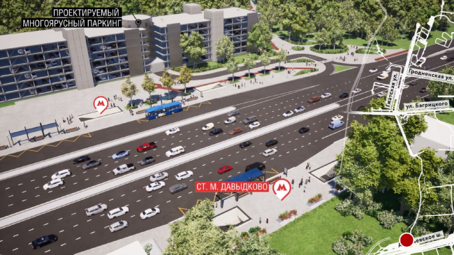
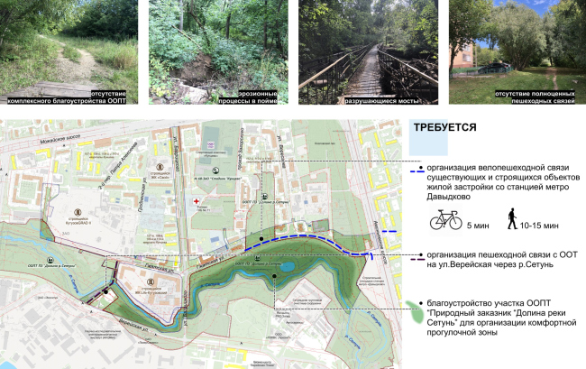
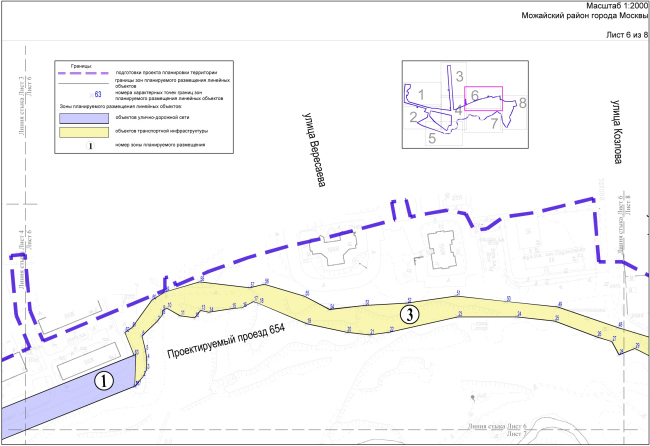
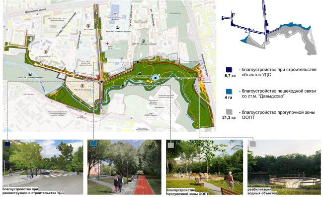
A story about how plans for laying a road on the border of a park turned into plans for saving the ecosystem and improving the walking trails. The valley of the Setun River in the west of Moscow is a place that has long since been well-known as an attractive place to live in – there are many new housing projects built on its banks, which should come as no surprise because being situated on the edge of a natural reserve, and by the river as well, is something that is definitely an advantage for a housing complex. One of such “lucky” housing complexes is Kutuzovsky Life, designed by ADM architects, received the territory in the bend of the river at the intersection of Gzhatskaya and Bagritskogo streets, which leads from Mozhaisk Highway to Aminevsky Highway. Under construction metro station Davydkovo. The site plan of the Gzhatskaya Street. Project visualizationCopyright: © Genplan Institute of MoscowUnlike the Bagritsky Street, the Gzhatskaya, which crosses it at a right angle, does not let you bypass anything because it stops in a dead end before the Zhukov Ravine in its eastern part. This is where one of the fragments starts of the special protection natural reserve “Setun Valley”. The city here feels more like a dacha settlement; five-story brick houses are interspersed with wooden Modernist houses, late-Soviet high-end residential towers, and even high-profile projects from architectural magazines (the ravine, for example, is overlooked by the east facade of the Catamaran House standing in the Zagorsky Drive). The land improvement challenges. The site plan of Gzhatskaya StreetCopyright: © Genplan Institute of MoscowThe height difference is about 30 meters from north to south – from the city area to the river bank – and essentially the whole territory (the ravine less so, the riverbank more) is a thick forest on a slope with an odd inclusion of a meadow, bogged creeks, a few wellsprings, lush riverside vegetation, windbreak and traces of the Setun floods. At the entrance we see a poster that speaks of dozens of species rare for Moscow, including weasel and ermine. And if you wander inside, especially in the western part, these statements are easy to believe. 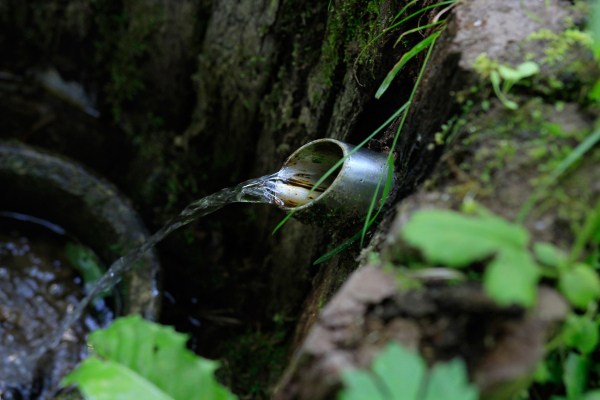 Valley of the Setun River in the area of Gzhatskaya street. The springwellCopyright: Photograph: Archi.ru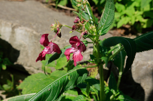 Valley of the Setun River in the area of Gzhatskaya street. Indian balsam (Impatiens glandulifera)Copyright: Photograph: Archi.ru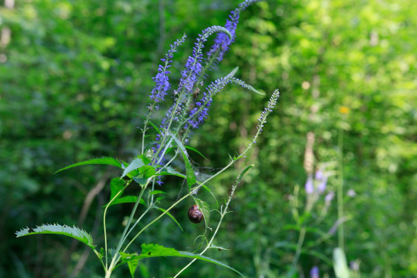 Valley of the Setun River in the area of Gzhatskaya street. Creeping speedwell (Veronica repens)Copyright: Photograph: Archi.ru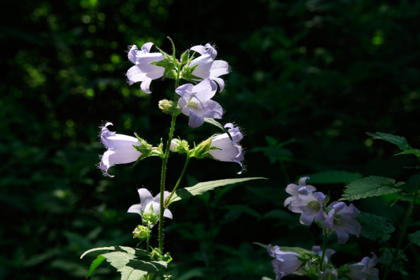 Valley of the Setun River in the area of Gzhatskaya street. Nettle-leaved bellflower (Campanula trachelium)Copyright: Photograph: Archi.ru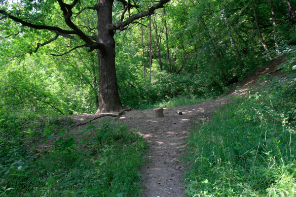 Valley of the Setun river in the area of Gzhatskaya street. Bungee oakCopyright: Photograph: Archi.ru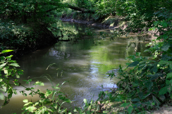 Setun river in the area of Gzhatskaya streetCopyright: Photograph: Archi.ru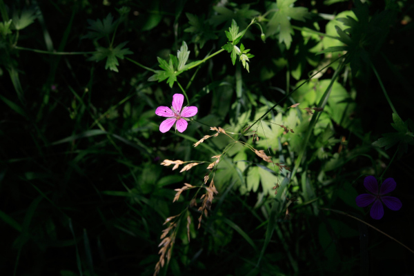 Valley of the Setun River in the area of Gzhatskaya street. Wood crane (Geranium sylvaticum)Copyright: Photograph: Archi.ruThe brook issuing from the Zhukov Ravine leads to a nearly-circular pond named Pyatachok; in the eastern part of the river a dead-end channel branches off – if the river flows cheerfully and vigorously, then the stagnant water is full of duckweed and requires cleaning. 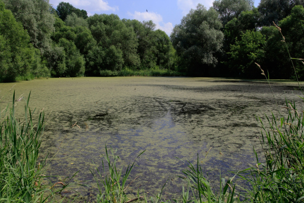 Valley of the Setun River in the area of Gzhatskaya street. The “Piglet” pondCopyright: Photograph: Archi.ru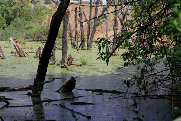 Boggy oxbow of the river in the eastern part of the territory. Valley of the Setuni River in the area of Gzhatskaya StreetCopyright: Photograph: Archi.ruSome time ago, the eastern part of the green territory was improved. What came first were probably the concrete staircases with metallic railings on the slopes, and metallic little bridges over the Setun; later on came boardwalks and wooden staircases in the western part, closer to the Aminievskoe Highway, then a few playgrounds were built. All of this, probably for the sole exception of one playground in the Zhukov Ravine, is now in a dilapidated shape: the boards are rotting and sometimes snap underneath your feet, the staircases are unsafe to walk upon, and even the metallic bridge has suffered from the river floods. According to experts, today the local residents walk in this place on the Setun bank at their own risk, and, indeed, when I took a walk in the part, people called out to me “Don’t go their unless you want to break your legs” more than once. In addition, for some reason, the improvement work stopped right in the middle of the park – the boardwalks stop short quite abruptly. But then again, there are also traces of enthusiastic activities of the locals: bungees, fireplaces, and even semblances of art objects. 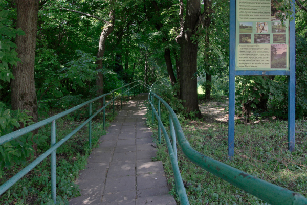 Entrance from Zhukov ravine. Valley of the Setun river in the area of Gzhatskaya street. The curret stateCopyright: Photograph: Archi.ru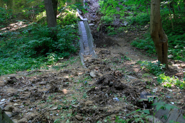 The washed fortifications of the banks of the stream in the Zhukovy ravine. Valley of the Setun river in the area of Gzhatskaya street. The current stateCopyright: Photograph: Archi.ru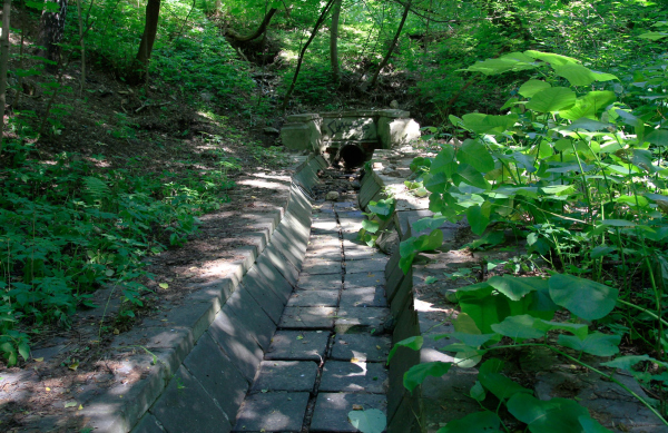 The washed fortifications of the banks of the stream in the Zhukovy ravine. Valley of the Setun river in the area of Gzhatskaya street. The current stateCopyright: Photograph: Archi.ru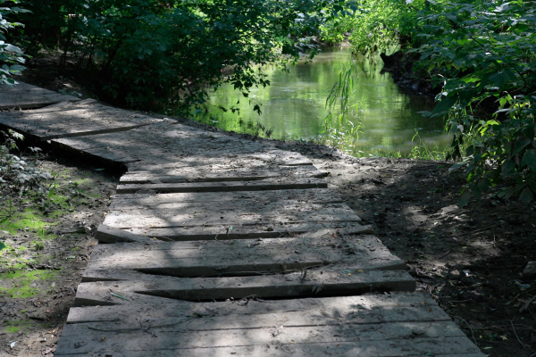 The boardwalks and stairs in the eastern part have rotted at some places. Valley of the Setun River in the area of Gzhatskaya street. The current stateCopyright: Photograph: Archi.ru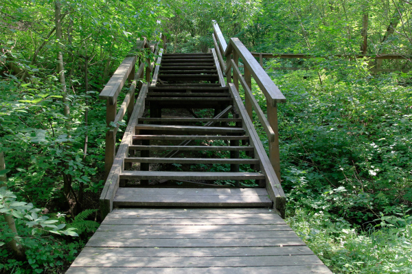 One of the stairways. Valley of the Setun River in the area of Gzhatskaya street. The current stateCopyright: Photograph: Archi.ru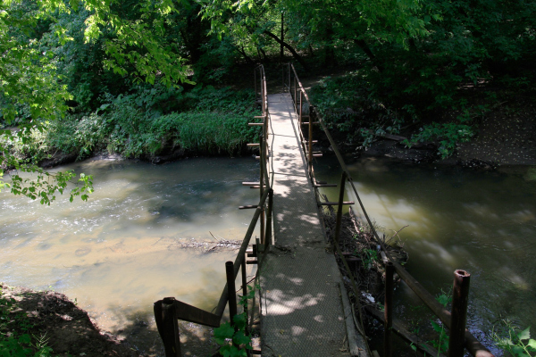 Bridge over the Setun. It has no continuation in the form of paths on the other side. Valley of the Setun River in the area of Gzhatskaya street. The current stateCopyright: Photograph: Archi.ru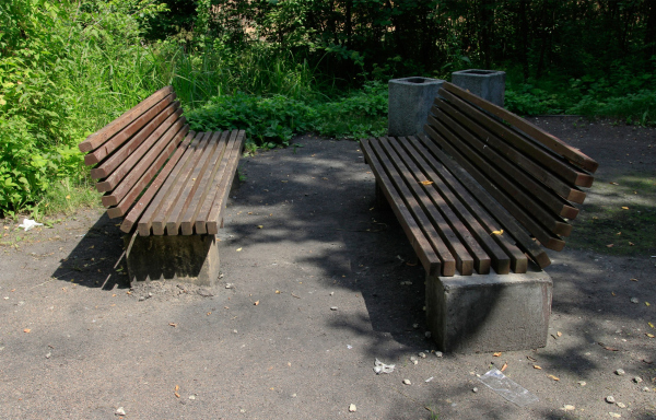 Elements of the existing improvement. Valley of the Setun river in the area of Gzhatskaya street. The current stateCopyright: Photograph: Archi.ru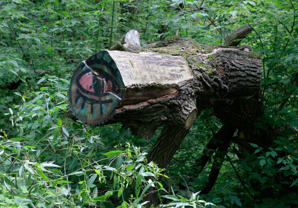 “Folk art” can pretend to be seen as an art object. Valley of the Setun river in the area of Gzhatskaya street. The current stateCopyright: Photograph: Archi.ruAnyway, the Gzhatskaya Street stops against the ravine in its eastern part, turning into a pedestrian trail. Meanwhile, 600 meters to the east, on the Aminievskoe Highway, the Davydkovo station of the Big Circle Line of the Moscow Metro is under construction. Thus, it made perfect sense that there were plans to extend Gzhatskaya to the highway, turning it from a dead end into an artery. The second task was the concept of arranging the green zone of the park around the residential complex Life Kutuzovsky and to the east, to the metro station. Both projects were commissioned to the Institute of the Master Plan of Moscow, and they started from a research which quickly demonstrated that laying a motorway along the northern border of the Setun Valley was not the best idea – something, with which the local residents eagerly agreed. The client also agreed with the objections and gave up the original plans for road construction. This decision was also supported by Moskomarkhitektura. Finally, the ecological reasoning prevailed – curiously, in an expensive part of the city, actively developing, and interested in motoring accessibility. The risk of extinction of rare species of animals and plants or the narrowing of their distribution area turned out to be more significant than the new automobile street. Yes, in Moscow. Fragment of the layout in the place where the automobile part of the street ends and the cycle route begins in the direction of the metro. The site plan of Gzhatskaya StreetCopyright: © Genplan Institute of MoscowThe authors of the project did quite a bit of preliminary research with input from appropriate experts. The research, on the one hand, showed the presence of rare species of animals and plants, and on the other hand, the need to rehabilitate the natural systems. In the site plan, which was ultimately developed, and which, as is known, is a sum of restrictions and allowances, as well as a basis for future detailed design, includes park furniture, paving the paths with square paving stones, an embankment with boardwalks running along the river bank, reconstructing two pedestrian bridges over the Setun, and building an underpass beneath the bridge of the Bagritsky Street. The project also includes a bicycle/pedestrian running from the metro station to the Aminievskoe Highway: a 10 minutes’ walking distance or 5 minutes on a bike or a scooter. The project does not include an excessive amount of recreation zones, but it does provide a comfortable access to the park for the residents of the nearby old and new buildings alike, leaving the “quiet” and “natural” character of this area unchanged. Proposals. The site plan of Gzhatskaya StreetCopyright: © Genplan Institute of MoscowIn addition to the park, the site plan includes a rather large surrounding territory, up to the Kutuzov Grad residential complex, and provides for the reconstruction of a few streets – specifically, the Petra Alekseeva Street, which exits to the Mozhaisk Highway, overhauls the engineering networks, Setun purification facilities, and making changes to the public transportation schedule. In other words, improving the park around the Setun is just a part of the mentioned narratives. 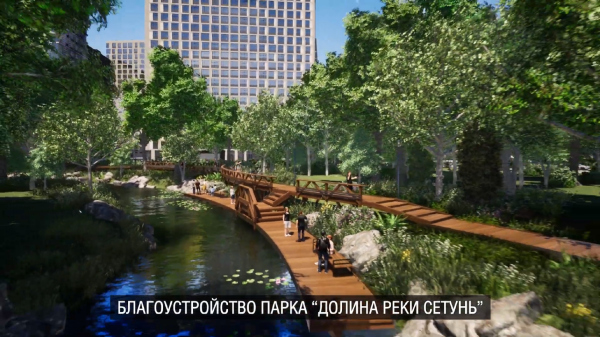 The site plan of Gzhatskaya Street. Project visualizationCopyright: © Genplan Institute of Moscow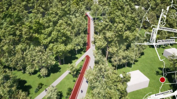 The site plan at the Gzhatskaya Street. THe project visualizationCopyright: © Genplan Institute of Moscow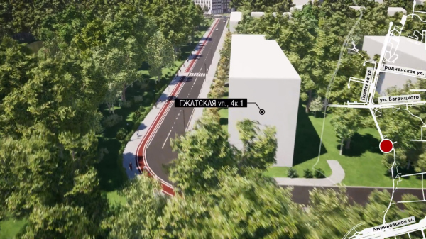 The place where the automobile section of Gzhatskaya Street ends in front of the Zhukov ravine. The site plan of Gzhatskaya Street. Project visualizationCopyright: © Genplan Institute of Moscow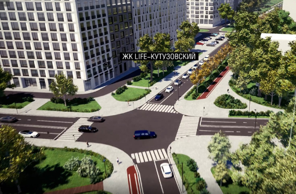 The crossing of Bagritskiy and Gzhatskaya streets, residential complex Kutuzovskiy Life. The site plan of Gzhatskaya Street. Project visualizationCopyright: © Genplan Institute of Moscow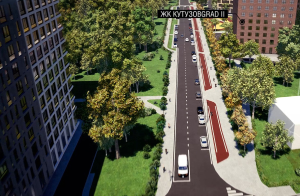 The site plan of Gzhatskaya Street near the residential complex Kutuzov Grad II. Project visualizationCopyright: © Genplan Institute of Moscow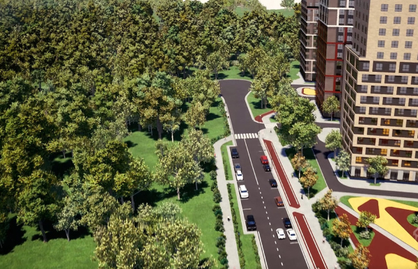 The site plan of Gzhatskaya Street near the residential complex Kutuzov Grad II. Project visualizationCopyright: © Genplan Institute of Moscow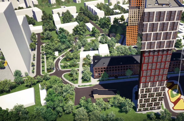 The site plan of Gzhatskaya Street near the residential complex Kutuzov Grad II. Project visualizationCopyright: © Genplan Institute of MoscowIt is not surprising that the specialists of the General Planning Institute consider the project unique in its own way. The “180 degree turn” in itself, from the road to the park with an ecological inclination and environmental rehabilitation, deserves attention, as well as the fact that the decision ultimately satisfied all participants in the discussion and design process. The materials are also planned to be used in the further development of the entire Setun reserve as a whole.  Yuliana Knyazhevskaya, Chairman of the Moscow Committee for Architecture and Urban Planning This project is yet another example of successful interaction between the investor and the city. The agreement was achieved thanks to an integrated multidisciplinary approach, and the main advantage of our developments is that they allow linking all solutions on the development of infrastructure – transport, protected areas, new housing areas, and areas of existing development, and contribute to the creation of a unified comfortable urban environment, taking into account the interests of all stakeholders. The project went through public hearings (see its page on the Active Citizen website). Presentation of the project on the Active Citizen website: *** We asked a few questions to Anna Ivanova, the head of the Urban Objects Designing Department at the Master Plan Institute:  The solution that you came up with in this project for the Gzhatskaya Street is far from trivial indeed. You reversed the whole narrative 180 degrees… How did you pull a stunt like that? On the one hand, a key part was played by the common sense of all the stakeholders of the process – we would like to emphasize that there were several sides involved in this project: us, the residents, the Department of Natural Resources, and, most importantly, the development company that initiated this project. Our joint work allowed us to find an unconventional, but, we believe, right solution. On the other hand, an important part was played by the specific approach utilized by our studio – with any of our projects, we start off with a research, collecting all the available information, and thinking bigger that is implied by the formal borders of the construction site. In this sense, our specialization is significantly broader than just land improvement. How would you describe the specialization of your studio as part of the Master Plan Institute? Our work consists of two major branches. The first one is integrated land improvement, or, to be more specific, a planning approach to defining zones and/or individual land sites that can be later on potentially improved during the implementation of various city programs. One of examples of this is our collaborative project with the Transport Engineering Center of the Master Plan Institute on Moscow Central Diameter 1, 2, and now 3. While our colleagues solve complex problems having to do with the organization of the road network adjoining the metro stations, we, on the other hand, consider not just the land on the immediate vicinity of the metro stations but also within a 1.5 km radius – in order to provide in our solutions the organization of connected, safe walking and cycling routes from all the buildings adjacent to the stations. We go to the site, analyze the current situation, but not only that – we also study all the projects that are being done for this territory, plans of all involved departments and other organizations, in order to get a complete picture not only in the present, but also in the planned future. Having received all the data, we study the strengths and weaknesses of the territory and form the sum of proposals: what could be changed to make this site more comfortable at a new stage of its development. I will emphasize: it is important that we always take our research a little bit further than just the land within the limits of the site plan. We design our projects based on their connection with the surrounding city space, and we study how they could best interact with their environment. In some cases, we also interact with third-party architectural companies – and such collaborations turn out to be very fruitful, one of the recent examples of which is the concept of Marc Chagall embankment in ZIL complex – we did it together with ASADOV architects. How do you go about implementing these things? How can you make your ideas a reality outside of your site plan? We form appropriate proposals and share them with our colleagues from other organizations – oftentimes such interaction sets off subsequent work and brings results. But, of course, the site plan still serves as a basis, and we make quite a lot of projects – take the Moscow Central Diameter, for example – this is a huge chunk of work that consists of numerous parts and involves various stakeholders. 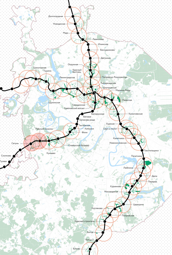 The project of developing the terrories around the Moscow Central DiameterGenplan Institute of Moscow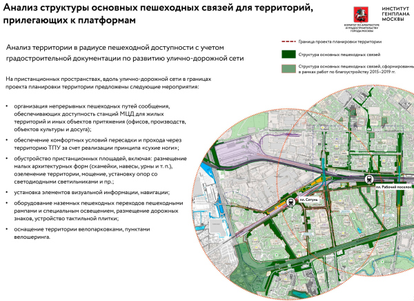 The project of developing the terrories around the Moscow Central DiameterCopyright: © Genplan Institute of Moscow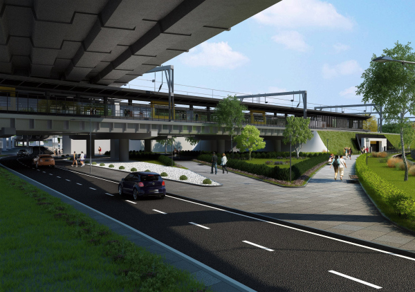 The project of developing the terrories around the Moscow Central DiameterCopyright: © Genplan Institute of Moscow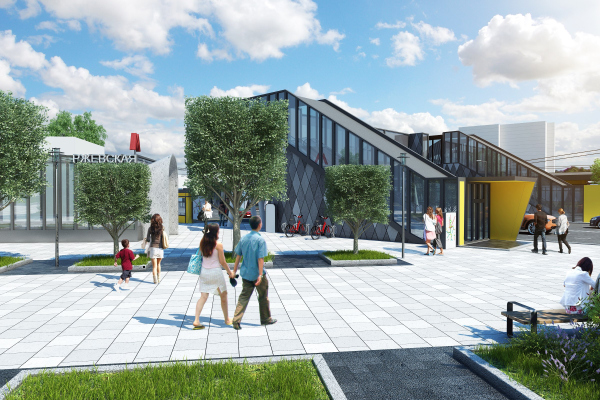 The project of developing the terrories around the Moscow Central DiameterCopyright: © Genplan Institute of Moscow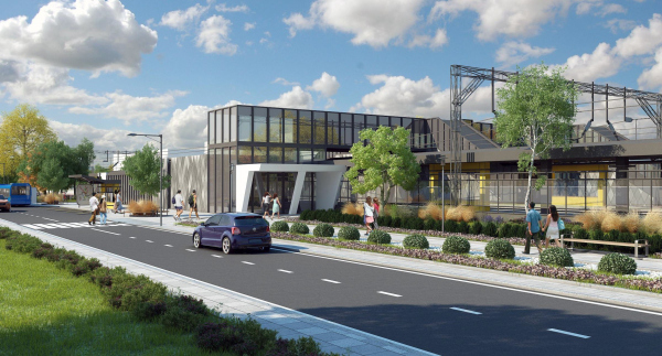 The project of developing the terrories around the Moscow Central DiameterCopyright: © Genplan Institute of MoscowYou said that your company has two specializations. What is the second one? The second one is visualizations of not just the projects that we are working on, but other projects done by the Institute. And, of course, it’s not just about beautiful pictures but about reflecting and representing the very essence of project proposals. Today, as we know, the land planning projects are submitted for online public hearings. In order to make sure that the solutions proposed in these projects are as clear and as visual as possible, we make not only presentations but also videos of those materials. This allows us to create a very accurate picture of the future urban territories. But I think our most important achievement is that we were able to put together our creative team that keeps on growing; we have excellent specialists and experts in their fields – architects, urban planners, landscape designers, geographers and biologists, and a dendrologist, all people with an all-rounded creative vision. |
|
